File:Fleming Island GIS Map Key.JPG
Size of this preview: 799 × 145 pixels. Other resolutions: 320 × 58 pixels | 1,547 × 281 pixels.
Original file (1,547 × 281 pixels, file size: 88 KB, MIME type: image/jpeg)
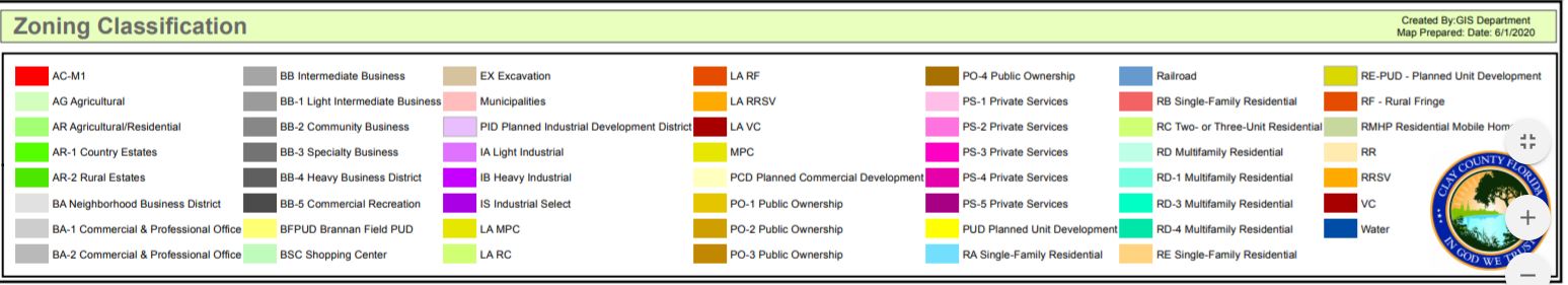
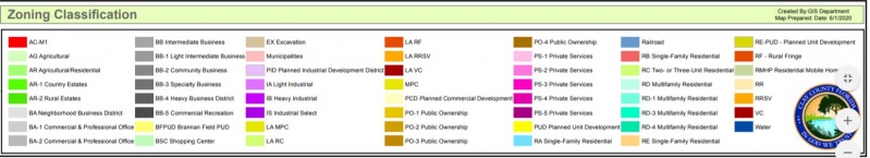
The key to the clay county GIS Map
File history
Click on a date/time to view the file as it appeared at that time.
| Date/Time | Thumbnail | Dimensions | User | Comment | |
|---|---|---|---|---|---|
| current | 17:24, 30 July 2020 | 1,547 × 281 (88 KB) | Eric (talk | contribs) | The key to the clay county GIS Map |
- You cannot overwrite this file.
File usage
The following page links to this file: